
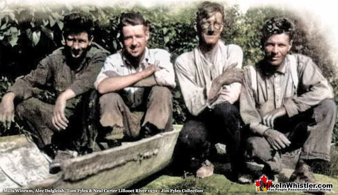
![]() Mills Winram was a very active mountaineer from Vancouver with some very notable ascents in the 1920's and 1930's. He, along with Fred Parkes and Stan Henderson made the first ascent of Mount Slesse in August of 1927. In 1932 Mills Winram, Tom Fyles, Neal Carter and Alec Dalgleish went on an exploratory expedition to the headwaters of Lillooet River, where they made the first known ascent of Mount Meager and several surrounding peaks.
Mills Winram was a very active mountaineer from Vancouver with some very notable ascents in the 1920's and 1930's. He, along with Fred Parkes and Stan Henderson made the first ascent of Mount Slesse in August of 1927. In 1932 Mills Winram, Tom Fyles, Neal Carter and Alec Dalgleish went on an exploratory expedition to the headwaters of Lillooet River, where they made the first known ascent of Mount Meager and several surrounding peaks.
Whistler & Garibaldi Hiking
![]() Alexander Falls
Alexander Falls ![]() Ancient Cedars
Ancient Cedars ![]() Black Tusk
Black Tusk ![]() Blackcomb Mountain
Blackcomb Mountain ![]() Brandywine Falls
Brandywine Falls ![]() Brandywine Meadows
Brandywine Meadows ![]() Brew Lake
Brew Lake ![]() Callaghan Lake
Callaghan Lake ![]() Cheakamus Lake
Cheakamus Lake ![]() Cheakamus River
Cheakamus River ![]() Cirque Lake
Cirque Lake ![]() Flank Trail
Flank Trail ![]() Garibaldi Lake
Garibaldi Lake ![]() Garibaldi Park
Garibaldi Park ![]() Helm Creek
Helm Creek ![]() Jane Lakes
Jane Lakes ![]() Joffre Lakes
Joffre Lakes ![]() Keyhole Hot Springs
Keyhole Hot Springs ![]() Logger’s Lake
Logger’s Lake ![]() Madeley Lake
Madeley Lake ![]() Meager Hot Springs
Meager Hot Springs ![]() Nairn Falls
Nairn Falls ![]() Newt Lake
Newt Lake ![]() Panorama Ridge
Panorama Ridge ![]() Parkhurst Ghost Town
Parkhurst Ghost Town ![]() Rainbow Falls
Rainbow Falls ![]() Rainbow Lake
Rainbow Lake ![]() Ring Lake
Ring Lake ![]() Russet Lake
Russet Lake ![]() Sea to Sky Trail
Sea to Sky Trail ![]() Skookumchuck Hot Springs
Skookumchuck Hot Springs ![]() Sloquet Hot Springs
Sloquet Hot Springs ![]() Sproatt East
Sproatt East ![]() Sproatt West
Sproatt West ![]() Taylor Meadows
Taylor Meadows ![]() Train Wreck
Train Wreck ![]() Wedgemount Lake
Wedgemount Lake ![]() Whistler Mountain
Whistler Mountain
![]() January
January ![]() February
February ![]() March
March ![]() April
April ![]() May
May ![]() June
June ![]() July
July ![]() August
August ![]() September
September ![]() October
October ![]() November
November ![]() December
December
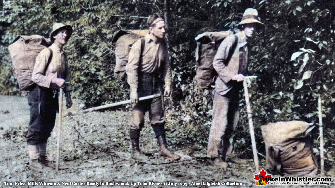
The following year, the same group set off to explore the mountains they had seen from Mount Meager to the west, toward the coast. To reach these mountains they took the long boat journey from Vancouver up into Toba Inlet and up Toba River. As Mills Winram recalled in an interview several years later,
"The Toba Inlet had been mapped. But the upper half of the Toba River, and the mountains above it, were unknown. So in July of 1933 , four of us set out to explore the headwaters of the Toba River. From the head of Toba Inlet two Indians took us in their fish boat up the river for about a day and a half. Then we switched to a little outboard-powered canoe and went for a day in that. The river got faster and faster, and finally it got too difficult to get around the bends. We had to be landed, and take to the bush. The valley is a typical glaciated U-shaped valley, with a relatively flat valley floor, and relatively steep granite sides down which waterfalls would come about every half-mile. In many places, it was so steep that the waterfalls would shoot out like a hose. We bushwhacked our way along the banks. We carried about fifty-pound packs , just standard knapsacks, no iron frames on them. But that was easier because you could crawl through heavy underbrush with nothing to catch on your back. We had to carry all our own food, as well as our bedding."
Fyles, Winram & Carter Toba River - 11 July 1933
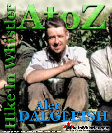
Winram, Dalgleish, Fyles and Carter Lillooet River - 1932
Mills Winram was born in 1907 in Manitou, Manitoba and while still young, his family relocated to Vancouver. After finishing high school, he started working in a fishing supply business and in 1925 he joined the British Columbia Mountaineering Club. He felt unsure of himself at his job, whereas in the mountains he seemed to excel. The positive nature of the BCMC and the excitement and friendships he made were a sharp contrast to his tedious day job. He recalled:
"Most young fellows don't know very much about their job when they start out and they make a lot of mistakes But I could go into the mountains and meet people with a different outlook altogether who didn't care about the mistakes I had made in the shipping office, and they would treat me as an equal, or at least be courteous to me. And I lived from weekend to weekend."
For Mills Winram, mountaineering introduced him to a wider world of people and experiences which he seemed to thrive on. Recalling his first mountaineering trip beyond the local mountains around Vancouver at the 1926 BCMC summer camp in Garibaldi Park.
"I met some extremely interesting people there. I shared the tent with a university professor and a leading lawyer from the city. And then, sitting around the campfire, there was a woman who had been to Russia. And this, of course, was like going to the moon in those days, and she gave us a talk on the Russian ballet, which I had never heard of. This is the type of thing that opens up for you the fact that there's more to life than just climbing mountains, or just writing out receipts in a shipping office."
1927: Mount Slesse First Ascent
Mills Winram, Stan Henderson & Fred Parks
The following year, in 1927, Mills Winram, Stan Henderson and Fred Parkes made an impressive first ascent of Mount Slesse. In the excellent book, In the Western Mountains: Early Mountaineering in British Columbia, Susan Leslie interviewed Mills Winram. In 1979, he recalled that remarkable ascent of Mount Slesse 52 years earlier:
We didn't have any carabiners or pitons or any extra things that people use today. Just our fingers to hold us on. Fred Parkes, being a relatively small man , could get into small chimneys and wiggle his way up, and then throw the rope down and pull the other two of us up. We went all day , and then about noon we realized that we couldn't possibly go back the way we'd come. We couldn't see where we'd come and we were afraid that we'd end in a precipice and just look over and have nothing to hold onto and we didn't have enough rope to rappel down the whole way. I think we had just about a hundred feet of rope. We had to keep on going. And under those circumstances, you can overcome a lot of drawbacks. Eventually, about 2 o'clock in the afternoon , we came out between the two peaks near the top. There was a little bit of a meadow and there was a goat on the meadow. He was absolutely amazed. He thought no human being could ever get there, and he ran away over the. hill. Then there was a little bit of chimney, which I didn't mind. Then I was about 100 feet below the peak. The others had gone up to the peak and I seemed to just run out of energy. I said, " I can't go any further. I'm going to go back. " And they just came down and laughed at me and tied a rope around me and said, "Come on. We' re there, so come up." So they pulled me up the last fifty feet. And then we looked around, and we were on the highest point all right. So we built a cairn, and we wrote in it, "Hope we get down all right."
 1932: Meager Expedition
August 8th-20th, 1932 Neal Carter, Tom Fyles, Mills Winram and Alec Dalgleish went on a spectacular mountaineering expedition up the headwaters of Lillooet River to Mount Meager. On day 5 Carter recalled, "the toe of a likely looking ridge at an elevation of 1750 feet opposite some hot springs on the bank of the creek was reached." The hot springs they saw are now well known as Meager Hot Springs. In the following days they climbed all six of the volcanic peaks of the Mount Meager massif and named the five unnamed ones. Mount Job, Capricorn Mountain, Devastator Peak, Plinth Peak and Pylon Peak were named. Beyond Meager, unknown peaks stretched to the ocean and another expedition was planned. Continued here...
 1933: Toba Expedition
The unknown mountains they saw from Mount Meager in 1932 were located at the headwaters of Toba River, which drained into Toba Inlet far up the coast of BC. In 1933, Neal Carter, Tom Fyles, Mills Winram and Alec Dalgleish teamed up again to explore this vast unknown. The remote Toba Inlet was reached by boat and the expedition involved boating upriver for several miles, then hiking great distances through near impenetrable forest. Despite weathering brutal terrain, considerable bushwhacking, and dangerous river crossings, they managed to make the first ascent of a towering and forbidding mountain they named Mount Julian. Continued here...
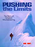 Mills Winram went on to graduate with a Masters Degree in Agricultural Economics from the University of British Columbia in 1933. The same year that he went on the search for the source of the Toba River with Tom Fyles, Neal Carter and Alec Dalgleish. When he wasn't hiking in the mountains he managed Winram Insurance, the family business. Well into his 90's he was still going into the office. In Pushing The Limits: The Story of Canadian Mountaineering, Chic Scott writes that. He later confided, "I was never the dare-devil type. Frankly I was scared a lot of the very difficult mountains." He says he climbed for curiosity. "Most of the maps were very good along the shoreline of BC, but there were blank spots once you got in. We felt we would like to explore these blank spots, but we had to learn to climb the mountains first." In June 2001, the Alpine Club of Canada honoured him for his 75th year of continuous membership in the club. At the age of 95 he was still active in the mountains, skiing with his grandson on Mount Seymour. Mills Winram passed away in Vancouver on January 10th, 2006 at the age of 98.
Guides to the Best of Whistler
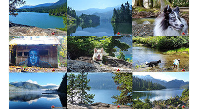 Best Dog Friendly Hiking Trails
Whistler is very dog friendly and the number of wonderful hiking trails that your dog will love is huge. The massively varied hiking trails range from easy, short, close to Whistler Village to challenging, long and deep in the endless wilderness around Whistler. You can find dog friendly trails in and around Whistler Village that take you through deep, dark and magical forests. Or you can drive beyond Whistler Village and take your dog to spectacular alpine lakes. Some requiring little or no hiking, while others are found after hiking challenging and long trails. Many of these places are comparatively quiet and often you and your dog will have the the wilderness to yourselves. In and around Whistler Village you have Lost Lake with its spider web of trails... Continued here.
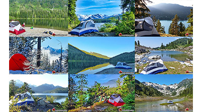 Best Free Whistler Camping
Whistler is surrounded by an immense wilderness dotted with spectacular, hidden lakes and amazing places to set up a tent. Decades of logging activity has left a network of forest service roads that has opened easy access to these places. Some of these you can drive to and some you may need a 4x4 to comfortably get to. Some places to camp for free you can drive to, some require a short hike and others are fairly long hikes to reach. Beautiful Callaghan Valley is home to several incredible and free places to camp. Callaghan Lake has a great free drive-to campsite just steps from this spectacular alpine lake. If you have a canoe, you can paddle to the end of Callaghan Lake and hike the short, but steep trail up to Cirque Lake. This gorgeous lake is deep in the alpine wilderness... Continued here.
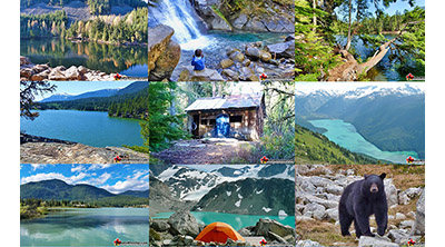 No Car? No Problem! Whistler Trails
Whistler as a resort has a wonderful car-free core. The Village Stroll runs through the heart of Whistler Village and is entirely car free. If you are visiting Whistler or living here and you don't have a car, it's no problem. On foot or on a bike you can travel the extensive network of non-motorized trails. The Valley Trail snakes through Whistler Village and extends in several directions, all of which lead to beautiful parts of Whistler. The Sea to Sky Trail and the Lost Lake trails continue this massive, car-free network of trails running almost everywhere in Whistler. When it comes to many of the best hiking trails, getting to the trailheads on foot, by bike or public transit can be tricky at best or complicated and impractical at worst. Many trailheads are far from Whistler Village and... Continued here.
 Kid Friendly Whistler Hiking Trails
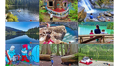
There are plenty of excellent, kid and family friendly hiking trails and destinations in and around Whistler. Kid and family friendly generally means an easy and somewhat short trail that a toddler can happily manage. Some of these trails are flat enough to be stroller friendly, such as Brandywine Falls, Whistler Mountain and Blackcomb Mountain. Others such as Logger’s Lake, Cheakamus River and Madeley Lake have short enough trails to reach them that you can manage with little kids that don't want to hike too far. Some of these hikes and walks are popular and close to Whistler Village, like Whistler Mountain, Blackcomb Mountain, Lost Lake Park, Rainbow Park and Meadow Park. Others are a beautiful, but far drive into the mountains and tricky to find... Continued here.
 Best Sights Sea to Sky 99
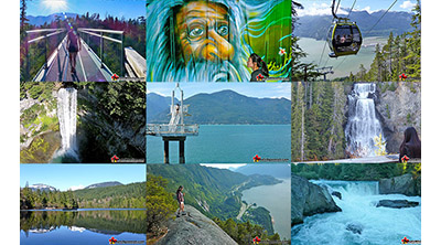
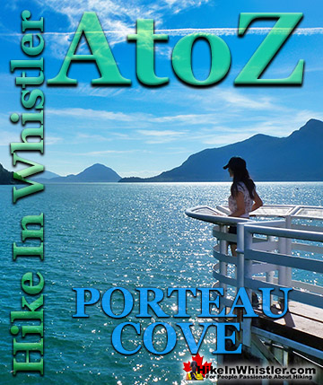
The Sea to Sky Highway links Vancouver to Whistler and has several stops along the way that are often overlooked. Porteau Cove, for example, is surprisingly unknown even to locals that have driven past hundreds of times. Just off the highway the parking area is just steps from the huge pier stretching way out over the ocean. This gigantic pier is actually a rarely used emergency dock for BC Ferries, though more often used by visitors for its stunning views of Howe Sound. Porteau Cove is an excellent pit stop on the way to Whistler, not only for the spectacular views of Howe Sound, but one of the nicest picnic spots and most convenient restrooms! Other attractions along the Sea to Sky Highway are more obvious, such as Shannon Falls, the Sea to Sky Gondola... Continued here.
 Best Whistler Waterfalls
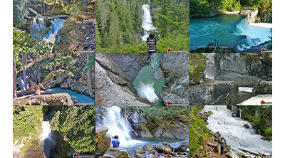
There are lots of beautiful waterfalls in and around Whistler. From the towering drop of Brandywine Falls to the awesome, up close and breathtaking view of Keyhole Falls. Some are absurdly convenient and easy to see and others require some tough hiking, or tricky driving to get to. All of them, however, are well worth a visit. Brandywine Falls is the most well known, impressive and easy to find along the Sea to Sky Highway. The viewing platform positioned across from the falls gives you a direct view of its 66 metre(216 feet) plunge into the chasm below. Located 17.1 kilometres(10.6 miles) from Whistler Village. The short, 1 kilometre long, dog friendly trail to the viewpoint is wide and smooth gravel. Alexander Falls, located up... Continued here.
 Whistler Aerial Views
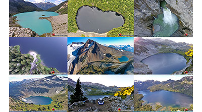
Aerial views of Whistler hiking trails give you a nice perspective on how beautiful this part of the world is. Wedge Glacier is hard to grasp its immensity from across the valley. Up close, from above, the endless rows of crevasses and massive contours give this hulking glacier a more complete picture. The mountains around Wedgemount Lake tower around the valley and seeing them in profile is a great way to grasp the wild, chaotic, boulder strewn landscape below. Along with Wedge Glacier and Wedgemount Lake we have some great aerial views of Panorama Ridge, Parkhurst Ghost Town, Russet Lake, Adit Lakes, Overlord Mountain, Overlord Glacier, Whistler Mountain, Blackcomb Mountain, Brandywine Falls and many more... Continued here.
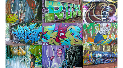 Whistler Train Wreck Murals
The colourful graffiti and murals that make Whistler Train Wreck the magical place it is today began appearing in 2011, when this hidden place was known by just a few Whistler locals. In the summer of 2011 several Whistler artists came here for "The Train Wreck Paint Jam" and transformed the mangled wreckage into a surreal art exhibit. The artists ranged from aspiring graffiti artists to professional artists like Kups. Remnants of one of his murals from 2011 is found inside the first boxcar you come to after crossing the bridge into Whistler Train Wreck. Several of the original murals were gorgeous. Brilliantly coloured and surreal in such an unusual, tranquil and hidden forest with seven mangled train boxcars scattered. Like some sort of haunting art gallery... Continued here.
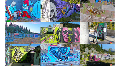 Northair Mine Murals
Way up in the Callaghan Valley on the back side of Mount Sproatt is an abandoned gold mine. Old cement foundations and two unexpectedly beautiful lakes mark the location of Northair Mine, abandoned in 1982. It was a fairly productive gold mine that extracted five tons of gold. Largely forgotten for years, in the last decade it has come to life in stunning colour by graffiti artists and professional muralists. In the summer of 2013, the first mural appeared on the blank foundation walls of Northair Mine. A creation of a professional Whistler artist PETKO. Painted on one of the inside, pillar walls, the mural is about 8 feet tall and five feet wide of what looks like a robot snake in front of a cube background. It stood out in striking contrast to the grey walls in the background... Continued here.
More Whistler & Garibaldi Park Hiking A to Z!
The Best Whistler & Garibaldi Park Hiking Trails!


Whistler & Garibaldi Park Best Hiking by Month!


Explore BC Hiking Destinations!

Whistler Hiking Trails

Squamish Hiking Trails

Vancouver Hiking Trails

Clayoquot Hiking Trails

Victoria Hiking Trails

The West Coast Trail


